The Places Between 14
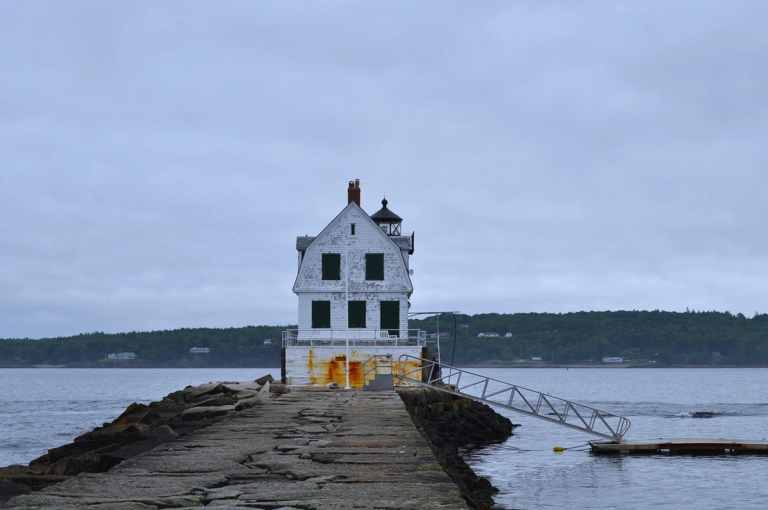
Rockland Breakwater Light
Perspective is a funny thing. Case and point: I didn’t realize how long the walk across Rockland’s Breakwater was until I was already 1,000 feet into it. The thick, stone structure totals 4,300 feet long. The salt water-stained lighthouse at its end was an unlit beacon that encouraged me to keep walking with the occasional stops to observe birds and the schools of jellyfish that lingered in the waves.
The Breakwater was a long and expensive project that took nine years to complete and over $800,000 in the 1890s. An additional four feet was added only a couple years later. Originally designed to protect Rockland’s harbor from devastating storms, the structure quickly turned into a navigational challenge for incoming vessels. Thus, the lighthouse was constructed soon after to guide ships to and from the harbor. Now, people like me hike across its surface for a chance to stand in the middle of the bay.
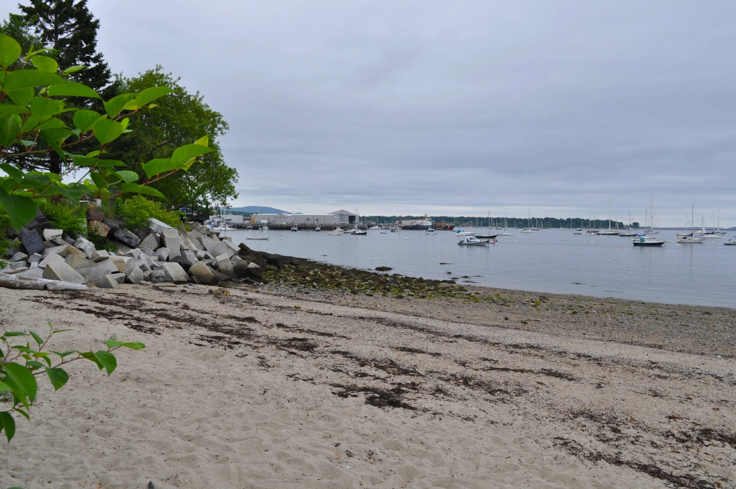
There are a million beaches called Sandy Beach, in Maine there must be at least half a dozen. However, the nearby Sandy Beach in Rockland might be better called Sand Turns To Pebbles Beach, but I guess that’s too much of a mouthful. Still, the sand is a welcome departure from the hard surfaces of the ledges and other rocky outcroppings that decorate Maine’s Midcoast. Just a few steps down from Rockland’s Harbor Walk, I could enjoy a slice of beach-life paired with an excursion across that had been patterned by melting glaciers 11,000 years ago. Across the sand and seaweed smothered stone, I could watch the fishing vessels move in and out of Maine’s working waterfront.
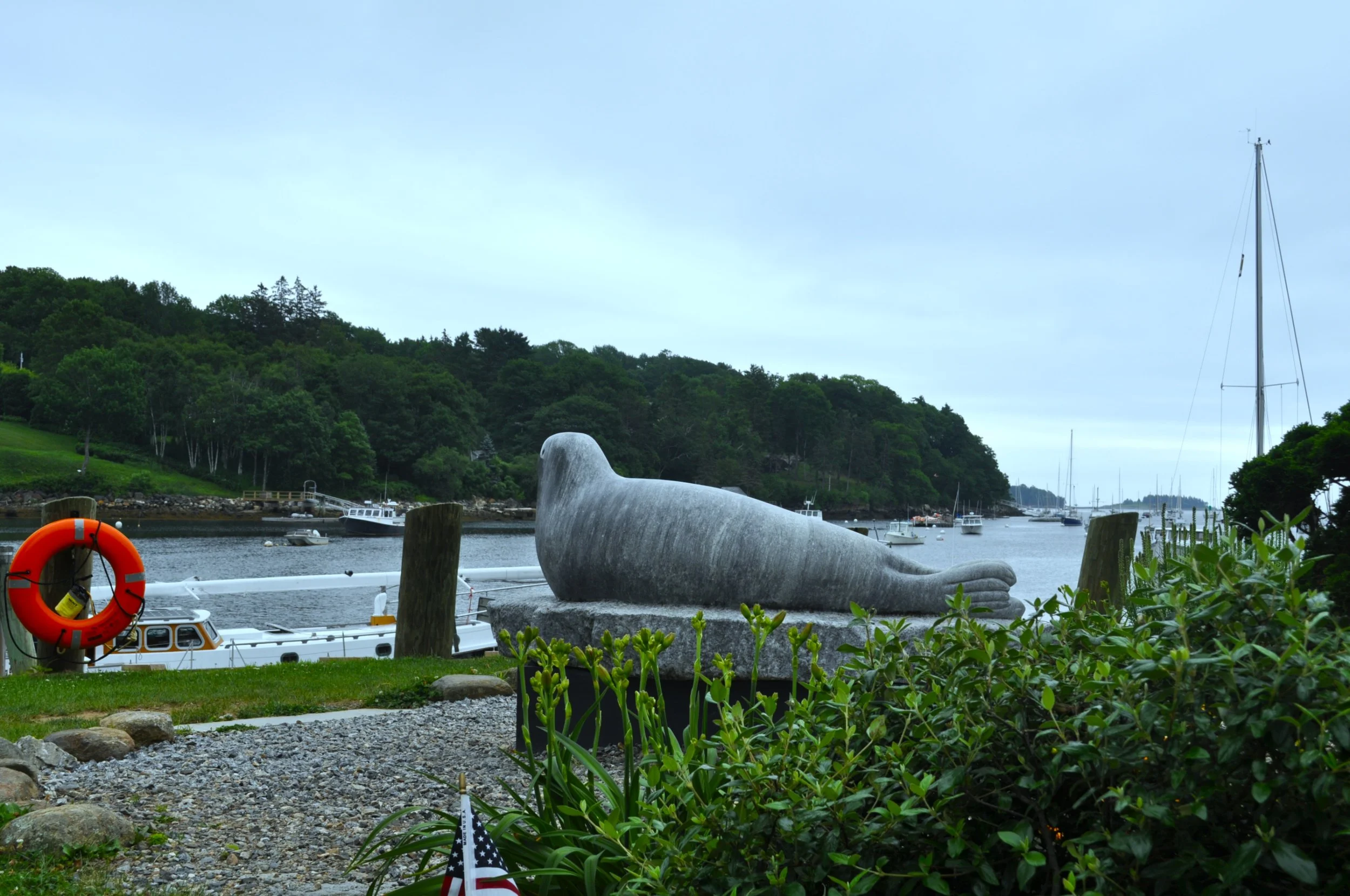
Just north of Rockland, is similarly named Rockport. Here, I stopped for an iced chai and a long chat with a friend at a nearby coffee shop. Afterwards, I walked down the hill by Rockport’s harbor and across the wooden bridge to Marina Park. Fishermen threw in a line from the docks, while I walked across the verdant grass to the art installation of a seal. There weren’t any real seals that I could see as I gazed across the water, but plenty of seagulls searched the park for abandoned lunches.
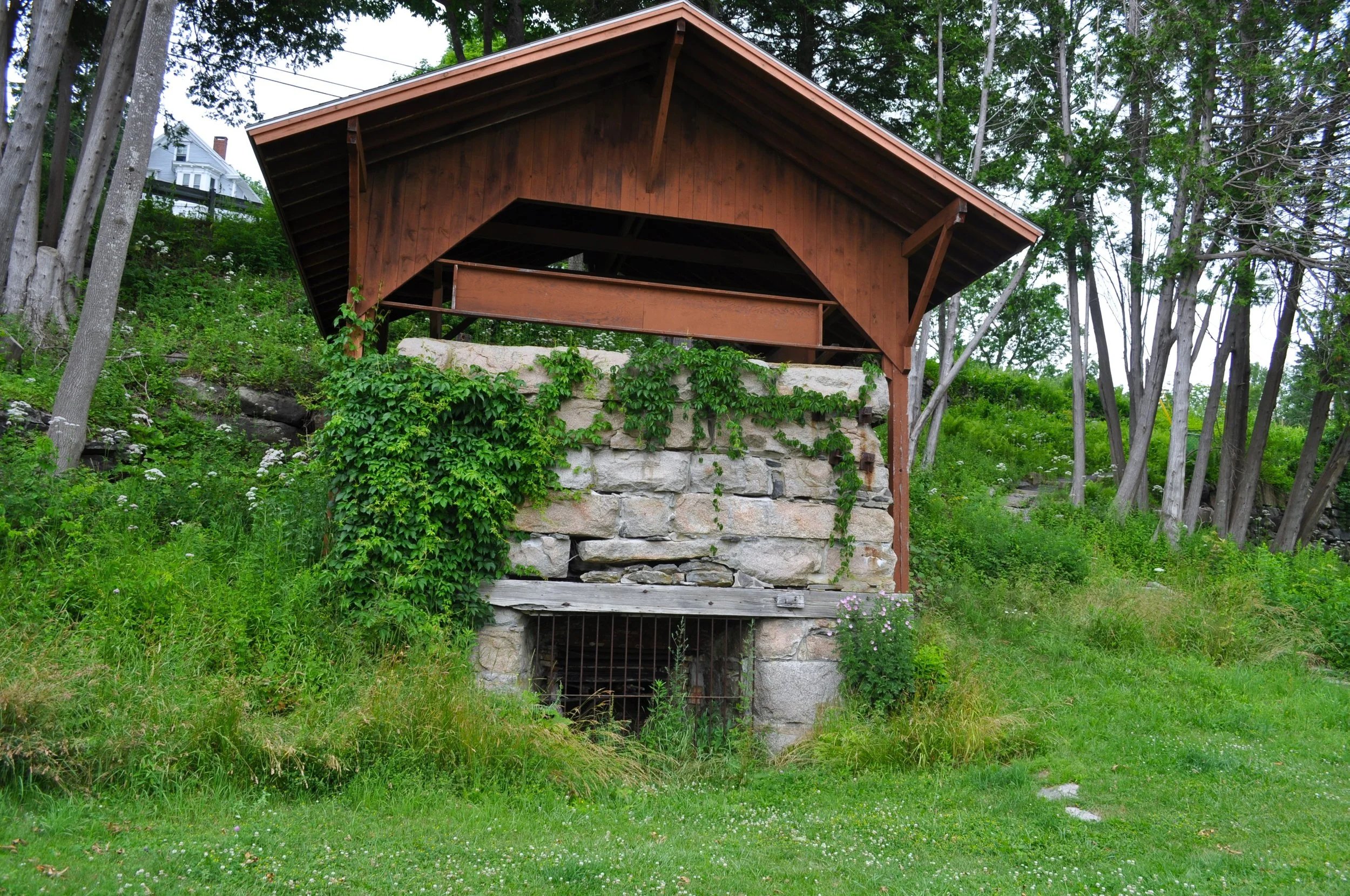
Sitting at the edge of the park at the bottom of the hill were three old kilns. Unlike most kilns, which burned wood, these kilns burned soft coal. Though long since decommissioned, they were pillars of Maine’s limestone industry. Built in the early 1800s, the kilns were supplied by 15 local quarries to make mortar and finish plaster. By 1859, it was a $100,000 industry, as workers would load limerock into the kilns, which burned continuously, before shipping the construction materials straight from the harbor and across the railway. Eventually, cement took limestone’s place in construction, and the kilns would become a historic site in 1970.
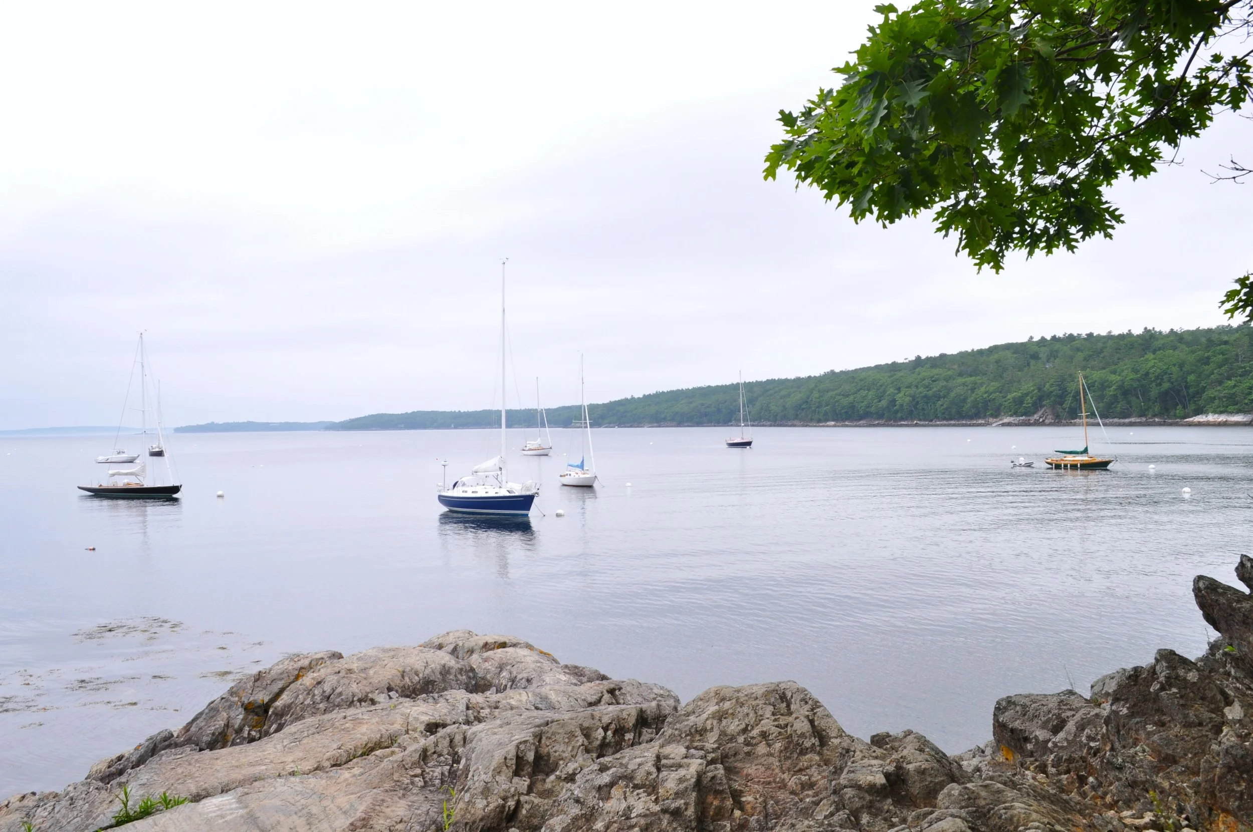
Beyond the harbor, tracing its way down an unpaved road in Rockport is a trail that leads to a scenic outlook. The Ledges is a nice stop along a jaunt beside the coastline. Though trees occasionally block views of the water, the road is well-kept with passing dog walkers and curious hikers interested in an easy stroll. I drove down most of the road, snagging one of the few parking spots where the trees part to make space for a quintessential Maine view of the ocean: wild roses blossom between the rocks, and trees reflect in the water where colorful buoys and boats float. I sat on the ledges for a bit as early afternoon light broke through an overcast sky, but I could imagine setting up a nice picnic here and watching the sunset.